
Amelia Urry
Supervisor: Richard Staley
I began my research curious about how the satellites’ eye–view had come to pervade so much environmental thinking in 21st century conversations about the climate, especially around notions of change. Ice loss, deforestation, sea level rise—these were all processes largely understood and communicated through satellite imagery.
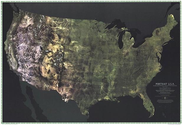
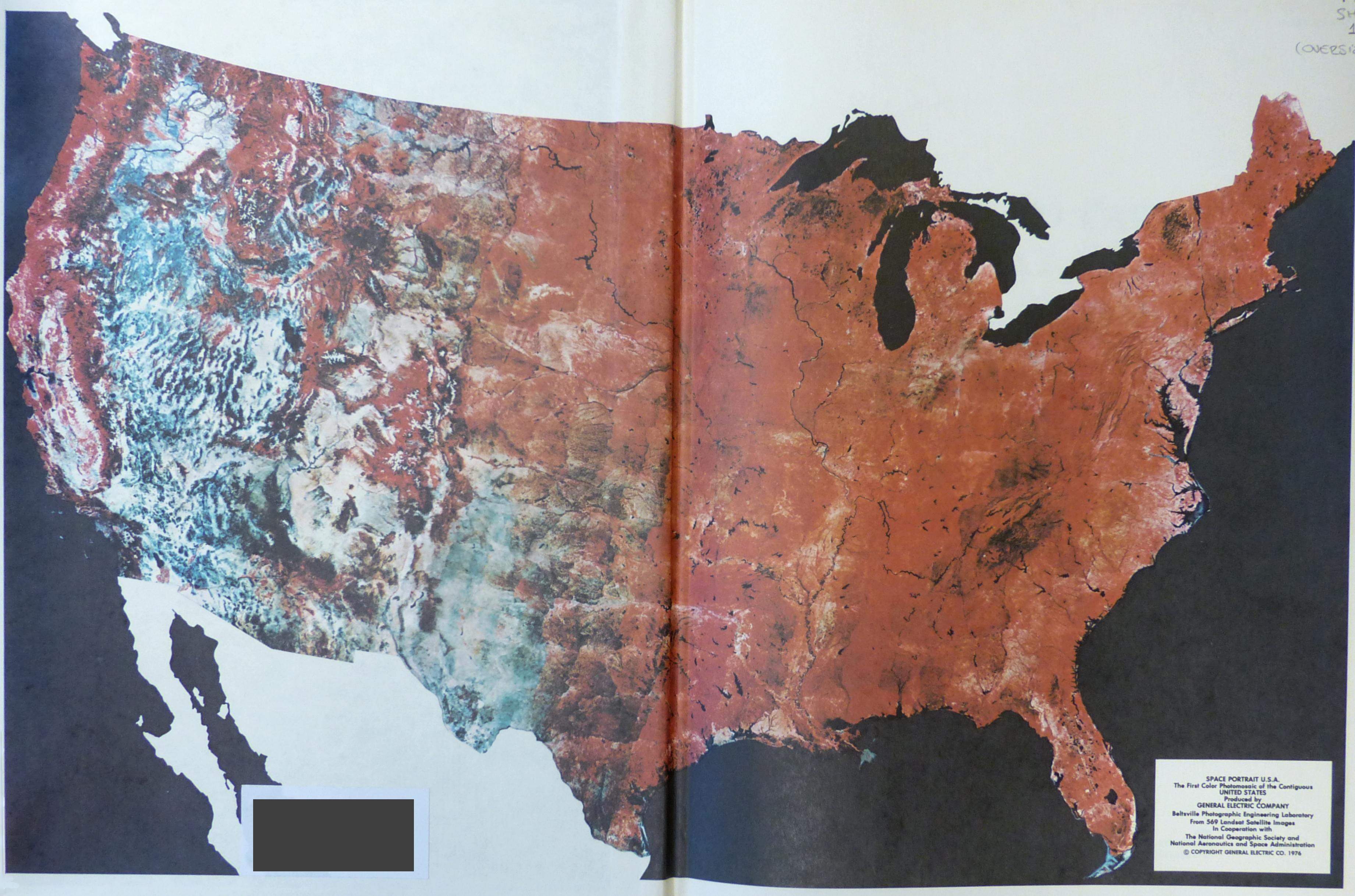
I went to the Map Room at the University Library to search the (extensive, not-fully-digitized, full-of-treasure) catalogue for historical satellite images. I came across this map produced in collaboration between NASA and the National Geographic Society in 1976, as part of a special magazine issue for the American Bicentennial. The first composite satellite image of the entire continental U.S., the map was a product of the first Landsat satellite, launched only a few years prior. The construction and dissemination of this image was manifestly the result of technical, political, and cultural processes, all of which shed light on the early role of Landsat in presenting explicitly environmental images of Earth.
Archivists at NASA and National Geographic helpfully provided scans of internal memos documenting the commission and publication of the map in the early 1970s. I also consulted the University Library’s copy of the July 1976 National Geographic in which “Portrait U.S.A.” appeared, as well as adjacent issues, to trace the magazine’s coverage of pollution, weather, satellites, and a growing dialogue of environmental problems at a global scale.
In the course of my research, I found references to a NASA monograph—a large coffee-table edition of some early Landsat images titled Mission to Earth—that the Whipple kindly acquired for me. The images in this book helped ground my thinking about the aesthetics of satellite images, and better understand the choices made by the technicians who created the image and the editors at National Geographic who produced it, in order to present a photographic “portrait” of a country.
Further information